Travel destinations Peru – History
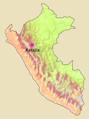
Karajia
48 km west of Chachapoyas.
Altitude
2400 m.
Climate of the nearby city of Chachapoyas:
January: 19,6 °C / 9,4
°C, February: 19,5 °C
/ 9,7 °C, March: 19,3 °C
/ 9,9 °C, April: 19,9 °C
/ 9,7 °C, May: 20,1 °C
/ 9,2 °C, June:
19,8 °C
/ 8,3 °C, July: 19,4 °C
/ 7,7 °C, August: 20,0 °C
/ 7,5 °C, September: 20,1 °C
/ 8,5 °C, October: 20,4 °C
/ 9,1 °C, November:
21,0 °C
/ 9,1 °C, December: 20,9 °C
/ 9,1 °C.
January: 78 mm, February: 92 mm, March: 137 mm, April: 82 mm, May: 34 mm,
June: 20
mm, July: 21 mm, August: 20 mm, September: 54 mm, October: 85 mm, November:
82 mm,
December: 745 mm.
Average relative humidity
Annual average: 74%.
Source of statistical data: Senamhi.
Foto: ANDINA.
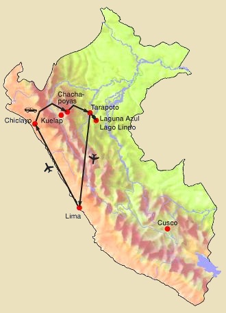
13 days / 12 nights
Round trip: Lima, Chiclayo,
Chachapoyas, Karajía, Kuelap, Leymebamba, Gocta, Tarapoto, Lamas, Laguna Azul, Tarapoto, Lima.
5 days / 4 nights
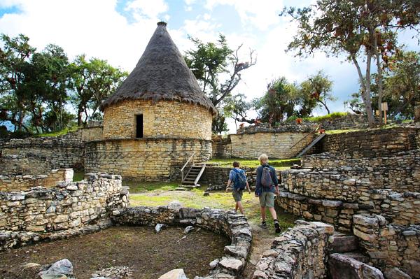
Travel to the mountains in the north of Peru, where the Chachapoya
people once lived, to get to know witnesses of their culture and
architecture (Kuelap, Karajía) and to marvel at Gocta, the third
largest waterfall in the world.
4 days / 3 nights
Hike in the northern Andes through impressive landscapes with small
rural villages and archaeological sites belonging to the Chachapoyas
culture.
Day trip
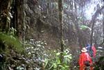
Huaylla Belén, an exceptional valley surrounded by cloud forest and
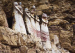
lush nature. The Karajía sarcophagi are a burial site of the
Chachapoyas culture.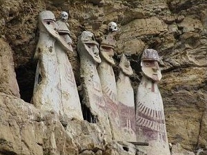 The sarcophagi of Karajia are unique tombs of the Chachapoyas culture
(1100 to 1300 AD) in human form, up to 2½ m high. They are on an enormous,
vertical cliff, which is extremely difficult to access.
The sarcophagi of Karajia are unique tombs of the Chachapoyas culture
(1100 to 1300 AD) in human form, up to 2½ m high. They are on an enormous,
vertical cliff, which is extremely difficult to access.
Geographical location
 Average high and low temperature
Average rainfall
Travel programs:
PTW-PER006
Northern
Peru
PTW-CHK001
Chachapoyas –
History and Nature
PTW-CHK003
Gran Vilaya
PTW-CHK006
Huaylla Belén and Karajía