Travel destinations Peru – Cities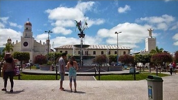
Rioja
Rioja, east of the Andes mountain ranges, is the gateway to the Amazon
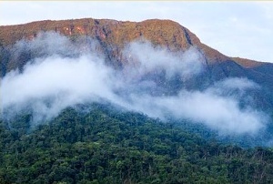
area. Its privileged geographic location brings picturesque landscapes
with mountains, valleys, waterfalls, caves, river springs, raised bogs,
lakes and a diverse flora and fauna. Rioja is also known as the «City of
Hats» due to the quality of the hats made from bombonaje fibers.
In northern Peru in the upper Mayo river valley, 20 km west of Moyobamba.
Geographical location
Population
About 42 000.
Average temperature
January: 22,7 °C, February: 22,7 °C, March: 22,8 °C, April: 22,8 °C, May: 22,5 °C, June:
22,1 °C, July: 21,7 °C, August: 21,9 °C, September: 22,4 °C, October: 22,8 °C, November:
23,2 °C, December: 23,1 °C.
Average rainfall
January: 135,1 mm, February: 134,2 mm, March: 180,2 mm, April: 147,4 mm, May:
104,0 mm, June:
79,8
mm, July: 72,3 mm, August: 73,4 mm, September: 106,7 mm, October: 156,8 mm, November:
145,1 mm,
December: 122,5 mm.
Average relative humidity
January: 75,1%, February: 76,6%, March: 79,1%, April: 79,4%, May: 78,7%, June:
78,5%, July: 77,5%, August: 75,0%, September: 75,6%, October: 76,9%,
November: 75,4%, December: 74,9%.
Source of statistical data: Weatherbase.
Photo: ANDINA.
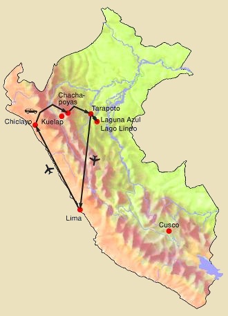
13 days / 12 nights
Round trip: Lima, Chiclayo, Chachapoyas, Karajía, Kuelap,
Leymebamba, Gocta, Tarapoto, Lamas, Laguna Azul, Tarapoto,
Lima.
4 days / 3 nights
Tours around Tarapoto with the
folkloric Lamas, the Laguna Azul lake, «Alto Mayo» (upper reaches of
the Mayo River) and waterfalls.
7 days / 6 nights
Combination of two important tourist centers in the north of Peru:
jungle area around Tarapoto + Andean mountains with historical sites
around Chachapoyas.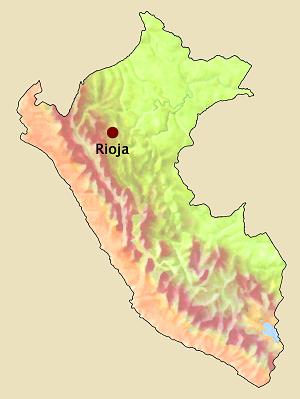
Altitude
848 m.
Travel programs:
PTW-PER006
Northern Peru
PTW-TAR001
Tarapoto with Lamas, Laguna Azul, Alto Mayo and waterfalls
PTW-TAR003
Tarapoto + Chachapoyas
