Travel destinations Peru – Nature
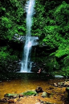
Ahuashiyacu
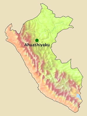
Ahuashiyacu waterfall, northeast of Tarapoto on the road to Yurimaguas
in the Cordillera Escalera Regional Conservation Area. «Ahuashiyacu» comes
from the Quechua language and means «laughing water».
14 km northeast of Tarapoto.
465 m.
Height of the waterfall
One drop at 60 m and another at 40 m.
Average temperature
January: 27 °C, February: 27 °C, March: 26 °C, April: 26 °C, May: 26 °C, June:
25 °C, July: 25 °C, August: 26 °C, September: 26 °C, October: 26 °C, November:
27 °C, December: 27 °C.
Source of statistical data: Weatherbase.
Average high and low temperature
January: 33 °C /
20 °C, February: 32,7 °C
/ 20,2 °C, March: 32,2 °C
/ 20,3 °C, April: 32,1 °C
/ 20 °C, May: 31,8 °C
/ 19,5 °C, June: 31,6 °C
/ 18,7 °C, July: 31,1 °C
/ 18 °C, August: 32,5 °C
/ 18,3 °C, September: 32,6 °C
/ 18,9 °C, October: 32,9 °C
/ 19,7 °C, November: 33 °C
/ 19,9 °C, December: 33,3 °C
/ 20,2 °C.
January: 102 mm, February: 101 mm, March: 156 mm, April: 116 mm, May: 105 mm, June:
71
mm, July: 58 mm, August: 68 mm, September: 103 mm, October: 122 mm, November:
86 mm,
December: 69 mm.
Source of statistical data: Senamhi.
Average relative humidity – Morning
January: 94%, February: 96%, March: 96%, April: 96%, May: 97%, June: 97%, July:
97%, August: 97%, September: 97%, October: 96%, November: 94%, December:
94%.
Average relative humidity – Evening
January: 63%, February: 64%, March: 67%, April: 68%, May: 66%, June: 66%, July:
63%, August: 63%, September: 64%, October: 64%,7 November: 64%, December:
63%.
Source of statistical data: Weatherbase.
Photo: ANDINA.
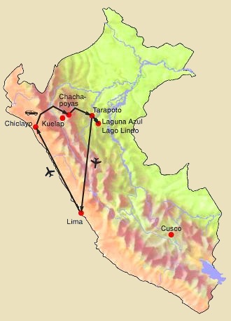
13 days / 12 nights
Round trip: Lima, Chiclayo, Chachapoyas, Karajía, Kuelap,
Leymebamba, Gocta, Tarapoto, Lamas, Laguna Azul, Tarapoto,
Lima.
4 days / 3 nights
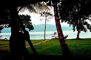
Tours around Tarapoto with the folkloric Lamas, the Laguna Azul
lake, «Alto Mayo» (upper reaches of the Mayo River) and waterfalls.
7 days / 6 nights
Combination of two important tourist centers in the north of Peru:
jungle area around Tarapoto + Andean mountains with historical sites
around Chachapoyas.
 Geographical
location
Altitude
Climate of Tarapoto, 14 km away:
 Average rainfall

PTW-PER006
Northern Peru

PTW-TAR001
Tarapoto with Lamas, Laguna Azul, Alto Mayo and waterfalls

PTW-TAR003
Tarapoto + Chachapoyas
